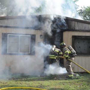
Winter Weather Advisory: Roads are slick, lots of accidents reported
Roads are slick and bitter cold is here. Wind chills are expected to be below zero. but a warmup is coming. By the weekend the highs will be back in the 60s and in the 70s to start next week.
WINTER WEATHER ADVISORY REMAINS IN EFFECT UNTIL MIDNIGHT CST
TONIGHT…
* WHAT…Mixed precipitation. Additional snow and sleet
accumulations up to one inch and ice accumulations around a light
glaze. Winds gusting as high as 40 mph.
* WHERE…Portions of east central, southeast, southern, and
southwest Oklahoma and northern Texas.
* WHEN…Until midnight CST tonight.
* IMPACTS…Plan on slippery road conditions. The hazardous
conditions could impact the Tuesday evening commute.
This Afternoon
A slight chance of freezing rain before 5pm, then a slight chance of snow showers. Cloudy, with a steady temperature around 13. Wind chill values as low as -7. North wind around 23 mph, with gusts as high as 34 mph. Chance of precipitation is 20%.
Tonight
A chance of flurries before 9pm. Cloudy, then gradually becoming partly cloudy, with a low around 7. Wind chill values as low as -11. North wind 14 to 18 mph, with gusts as high as 28 mph.
Wednesday
Mostly sunny, with a high near 25. Wind chill values as low as -11. North wind 13 to 16 mph, with gusts as high as 24 mph.
Wednesday Night
Mostly clear, with a low around 7. Wind chill values as low as -2. North northeast wind 6 to 11 mph.
Thursday
Mostly sunny, with a high near 27. Northeast wind 6 to 8 mph.
Thursday Night
Mostly cloudy, with a low around 13.
Friday
Mostly sunny, with a high near 36.
Friday Night
Partly cloudy, with a low around 21.
Saturday
Sunny, with a high near 53.
Saturday Night
Mostly clear, with a low around 29.
Sunday
Sunny, with a high near 66.
Sunday Night
Mostly clear, with a low around 35.
Monday
Sunny, with a high near 76.
Monday Night
Mostly clear, with a low around 41.
Tuesday
Sunny, with a high near 73.
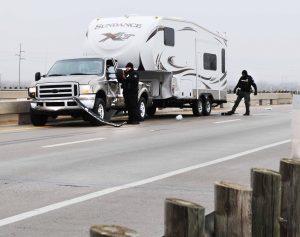
At least 8 accidents have been reported in Wilbarger County today due to iced roadways.